Gulu town
Gulu town is a town located in Northern part of Uganda, it's a commercial district with an administration. It takes approximately 320km from Kampala the capital city of Uganda. It's the biggest town in the northern parts of Uganda near the border of Sudan, it also borders Moyo, kitgum, Apac, Masindi, Arua, and Nebi.

Gulu as a district is divided among different towns; Lamwo in the North, Nwoyo south west, pader East, Oyoma south, Amaru west and two counts that's Aswa and Omoro. It has an area of about 11715.7km2, with 468500 people and 113200 in the main town.
The town was less developed in the 18th to 19th century, during this period Gulu was known as a place for war between the Uganda Army and Lords Resistance Army which were fighting over each other for 2 decades and a lot of villages were raided causing a lot of people to die and others were set for security in the first and Second World War.
Language
The main language spoken in Gulu is Acholi followed by Luo, Swahili, English and Luganda, with majority of people who are Christian.
Economic activity
The main economic system is Agriculture with the main emphasis of growing food crops like simsim, millet, groundnuts, cassava and cash crops like cotton and Tobacco, vegetation cabbage, with fishing on the western part of River Nile.
Commercial banks include Stanbic bank, bank of Uganda, centenary bank, finca bank.
Gulu district has the second largest Airport in Uganda next to Entebbe Airport.
It's a home of Gulu University ranging in Agriculture, medicine, Business management next to Muni University in Arua.
Gulu town has a flat terrain, thick savanna grassland, vegation with in central and forest reserves.
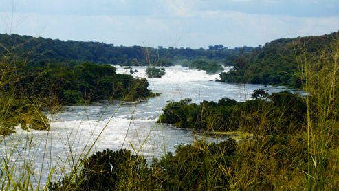
The area is characterized by forested valleys along the river from highlands towards Victoria Nile, Achwa River, Albert Nile, rivers from the island include River Tochi, River Ayugi River Apar etc.
There is a Tarmac road from Gulu to Masindi through Apac and also other marram roads connecting to different towns , counts, sub-counts, perish and villages of Gulu.


